AustLit
-
-
Gundagai was established as township in 1838, and plans for the new settlement were advertised for viewing in the office of the surveyor general, Sydney. The name is said to mean two things in the local language: "a place of birds" or "to cut with a hand-axe behind the knee".
The area, long inhabited by the Wiradjuri mob, was first explored by colonial settlers Hamilton Hume and William Hovell in 1824.
In 1829, the British Explored Charles Sturt passed through the Gundagai and greater Riverina area in his search for Australia's Inland Sea. He was suprised to discover that though the area was considered "beyond the limits of location", setllers were already living there: Henry O'Brien, William Warby and the Stucky brothers Peter and Henry.
From 1838 to 1839, Gundagai was witness to a long and terrible drought, and the Murrumbidgee decreased significantly in size. Despite warnings from the local Aboriginal population, the town was established on the flood plains. The name Murumbidgee itself is said to come from an Aboriginal warning "Mor-unbeed-ja", meaning "big flood".
In 1844, seven years before our story takes place, the Murrumbidgee flooded and most of Gundagai was inundated up to 1m. The towns people petitioned Govenor Gipps to release land on higher ground, but were denied. As you can imagine, the government received a lot of outrage for this decision following the 1851 disaster.
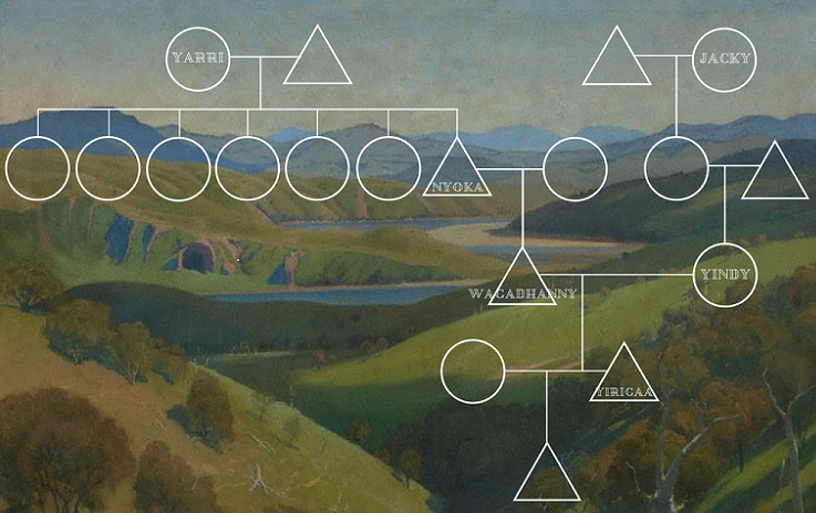
At the time of the 1851 flood, Gundagai town had a population of ~397. Somewhere around a thousand people lived in the surrounding district. One person of Chinese origin lived in the town, and seven others in the district. An annual report made by the Comissioner of Crown Land of Cullendina-Lower Murray William McKenzie stated that the Aboriginal people who lived in and around Gundagai, consisted of 35 groups. The report does not state the number of people in each group. James Gormly of Nangus station stated that when he first came to Gundagai in 1842, that "the blacks (sic) were very numerous."
Gold was first discovered in Gundagai by Rev. W. B. Clarke, a geologist. A gold rush hit the area in 1858 following further discoveries of gold, mining continued until 1875.
Gundagai's economy is still driven by sheep and cattle, wheat and maize.
-
During their exploration of the Riverina in 1824, William Hovell and Hamilton Hume kept detailed and descriptive diaries in which they documented nearly every day of their journey. A book comprised of these writings and edited by Alan Andrews is available at the Fryer Library; I have read through the parts of the book pertaining to the areas you are concerned with and have compiled a list of some of the more descriptive and telling elements. I hope you will find this a useful resource.
Hovell's first descriptions of the Riverina portray a beautiful landscape crisscrossed with sheoak-lined rivers and low meadowlands containing "a fine grass like English-Rye, wild clover, burnnet and Lucern". The surrounding ranges where forested, the "higher spells of the plains where scattered with massive pieces of granite rock" and the lower plains featured some bogs or quagmires created from the draining of the surrounding hills. The colonial explorers also kept a list of the native fauna, notably kangaroos, emus, black swans, snakes, "delicious fish", crayfish (which they called lobsters), and wombats. As they ventured in the Tumut area, they encountered hordes of small flies and incessant mosquitoes.
Hume and Hovell wrote very distantly of the local Aboriginal people and viewed them through an unwavering ethnocentric lens. Often times, they will would record days without an interaction with the Aboriginal people and mostly just recorded seeing the smoke from their fires in the distance. That the Aboriginal people possessed a deep knowledge and understanding of their home was clear to explorers; they followed their paths through the mountains and noted that "few things which they pass can escape their penetrating eye". In the diaries of these two explorers, it it also clear to see that the local Aboriginal people where modifying and caring for the landscape as well as practicing agriculture: They saw evidence of grass burning and forest management and witnessed how "along the rivers, the natives would draw fish into manufactured lagoons and poisoned them with willow bark". What is more, they noted how "along the rivers, people ground wild oats, seeds and legumes and ate it as a paste" or cooked the dough over hot coals to create a kind of bread.
The writing is at times, sparse, and the language a little archaic, but I think that, given that this book could be the first written account of the area, there is a lot to discover about the state of the landscape prior to colonial settlement.
-
In his book "The Biggest Estate on Earth", Bill Gammage compiles the descriptive notes of many an early explorer writing about the state of Australia in 1788. I have compiled a list of notes for you concerning the Murrumbidgee and the Gundagai area. It should give you a look into the state of the land before and during the early years of colonialisation in the area and also a view of how the land has changed. Much of the "meadowland" discussed in the book is a product of Aboriginal burning practices.
-- In 1850, Charles Strutt depicted a Murrumbidgee that is not recognisable today. "It was a fine stream, running over pebbles"; and at Gundagai, "it had clear water; "and at Bangus, "there was a convenient ford where the water was about three feet deep, very clear anmd was flowing over pebbles"; and the river was "here and there shallow but now and then deep with great holes". Most of the holes, so favoured by fish and fishermen have silted up, and the river above Gundagai is more sandy than pebbled. There are no more fords.
-- between the plains and the Murray, there used to be clear swamp, but it is now an area choked up with impenetrable reeds.
-- Sturt thought the Murrumbidgee "beautiful... Every creek abounded with fowl, and the quail sprung from the kangaroo grass which waved to the very flaps of the saddle".
-- In the 1840's it was written, that "the Murrumdigee lats were impossible to be finer... extensive grassed meadows, with a few clumps of trees... a succession of ornamental parks that would vie with the finest forest-lands in the world".
-- "In smmer, Murrumbidgee people frequented the swamps more than the river. People blocked parts of the river to extend the swamp lands" (fowl, a favored food source, inhabited the swamp lands).
-- "Murrumbidgee people invariably set aside some parts as breeding places or animal-sanctuaries. Where there were plains by a river, a part was left undisturbed for birds that nested on the ground. They did the same thing with lagoons, rivers, billabongs for water birds and fish. the law of sanctuary in regards to large or wide breeding-grounds was that each year, a part of the are could be hunted and fished, but not the same part two seasons in concession".
-- In the 1840's two tourists in the Gundagai area "found beautiful meadowland, bounded by sloping ranges of hills covered with grass and thinly timbered. Generally speaking, all fertile lands in Australia appeared to be characterised by these beautiful features".
-
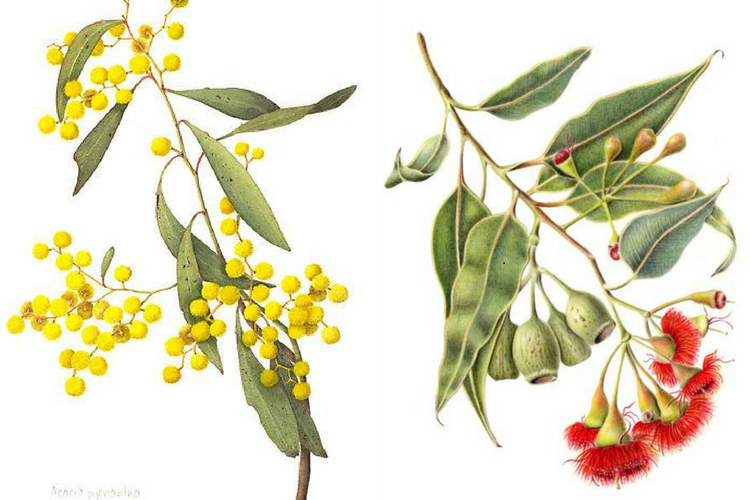
The land around Gundagai was extensively cleared for grazing and there are few remaining examples of the remaining vegetation. The plains between rivers are often treeless, comprised of native grass and salt bush, though along the fertile river banks one can find an array of trees, namely beautiful gums: Red Gums, River Cooba, Black Box, Salt Bush, Yellow Box, Grey Box and Cyprus Pine.
-
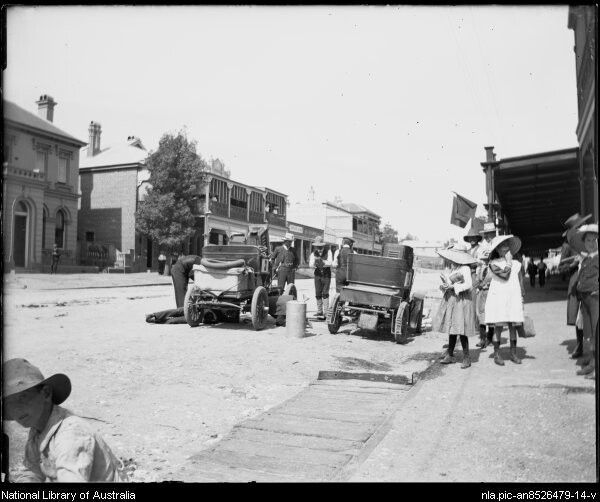
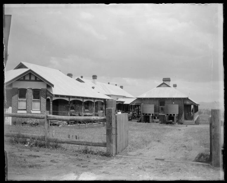
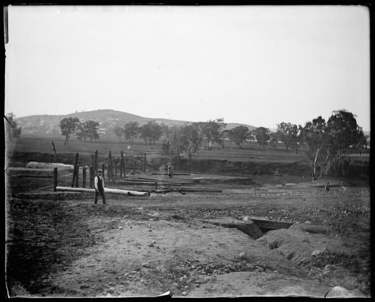
Louis Gabriel (1857 - 1927) was a doctor and medical practitioner who lived in Gundagai which became an import subject in his work. His photographs are now kept in the National Library of Australia
-
--
-
--
-
 - -
- - -
James Gormly arrived in Sydney with his Irish Parents, Patrick and Mary, and his four siblings in 1840. They settled in Illawarra where James was lost in the bush for 48 hours. In 1844 the family moved to Nangus on the Murumbidgee. They owned Nangus Station where Yarri worked as a shepherd. In 1849 the family settled in Gundagai. In 1952, during the Gundagai flood, all the Gormly family drowned save for James and his brother Thomas - James was 15 at the time and recalls, may possibly have been rescued by, Yarrie and his efforts.
The brothers had some success on the Victorian Gold fields, and for years, James worked as a farmer-type before getting into politics: He was twice appointed to be the Mayor of Wagga Wagga and eventually made his way into The NSW Legislative Council where he served from 1904 until his death at 87 in 1922. During which time, the Aborigines Protection Act was in full swing.
He married his wife Magaret Jane Cox in 1858. They had five sons and three daughters.
Sources:
http://adb.anu.edu.au/biography/gormly-james-3641
http://www.parlpapers.sl.nsw.gov.au/display.cfm?parl_id=7000
https://www.csu.edu.au/research/archives/collection/regional/agencies/gormly
-
Conor, Liz. Skin Deep. UWA Publishing , 2016.
Conor, Liz. "‘Black Velvet’ and ‘Purple Indignation’: Print responses to Japanese ‘poaching’ of Aboriginal women". Aboriginal History Journal, vol.37, 2013, pp. 51-76.
Smith, Maureen. Under the Quandong Tree. Quandong Dreaming Publishing, 2007.
You might be interested in...
